
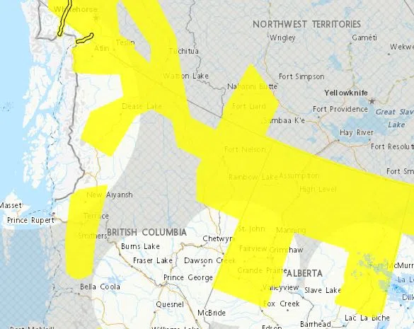
A period of extreme cold and dangerous wind chills is expected across northern B.C., the North Coast, and southern Yukon.
In northern B.C., wind chill values could reach minus 45 from tonight through midday Thursday in Atlin, Dease Lake, Muncho Lake–Stone Mountain Park, and Fort Nelson. An Arctic ridge of high pressure is bringing frigid temperatures, with the coldest conditions expected between Tuesday night and Wednesday night. Some moderation is expected by Thursday.
Environment Canada warns frostbite can occur within minutes on exposed skin. Residents are urged to dress warmly, cover all exposed areas, and keep emergency supplies in their vehicles, including blankets and jumper cables.
Strong Arctic outflow winds are also affecting inland sections of the North Coast, including Terrace and Kitimat, through Wednesday morning. Gusts up to 60 kilometres an hour are driving wind chill values near minus 20, despite air temperatures between minus 9 and minus 11. Conditions are expected to improve Wednesday afternoon.
People are advised to limit outdoor activities, provide adequate shelter for pets and livestock, and take frequent warm-up breaks if working outside.
Meanwhile, southern Yukon is also under an extreme cold warning. Wind chill values between minus 45 and minus 50 are expected through late Wednesday for Whitehorse, Teslin, Kluane Lake, Champagne Landing, Watson Lake, and the Cassiar Mountains. Some moderation is expected Wednesday night into Thursday.
Extreme cold poses a risk to everyone. Health officials urge residents to watch for signs of frostbite and hypothermia, including numbness, colour changes in fingers and toes, muscle weakness, chest pain, and shortness of breath.


Comments