
A strong storm system approaching the BC Coast has triggered flood watch’s and high stream flow weather warnings for along coastal in BC
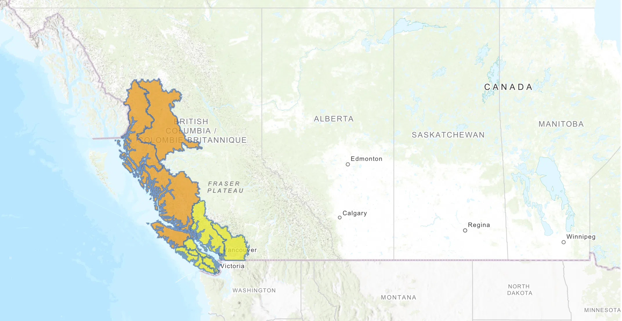
The River Forecast Centre has issued a Flood Watch for the Skeena , North Coast, Central Coast, and North Vancouver Island. Meaning that river levels have exceeded bankfull or will exceed bankfull imminently, and that flooding of areas adjacent to the rivers affected will result.
A High Streamflow Advisory has been issued for the South Coast, Lillooet River, Lower Mainland, Vancouver Island (West, East, South). Meaning that river levels are rising or expected to rise rapidly, but that no major flooding is expected. Fast-flowing bodies of water increase risk to life safety.
The Skeena River tributaries includes areas around Terrace and Kitsumkalum, North Coast rivers and tributaries includes areas around New Aiyansh-Nass River Prince Rupert, Kitimat and surrounding areas. Effect Central Coast areas include the Kingcome River and Wannock River (Wuikinuxv) North Vancouver Island river and tributaries.
A VoyentAlert! had been issued this afternoon for effected communities
In addition, the Regional District of Kitimat-Stikine had issued a joint hazard notice with Kitsumkalum and Kitselas for the Kitsumkalum River, Skeena River and tributaries.
The River Forecast Centre says rivers are expected to rise rapidly on Thursday and into Friday in response to heavy rainfall. With the focus of heavier rainfall on the North Coast, rivers are forecast to potentially reach or exceed 5-year return period flows. The Centre says Heavy rain and high streamflow bring increased risk for unstable banks, river erosion, submerged roads, swift water hazards, flooding and landslides.
They have recommended stay clear of the banks of swift running rivers and never drive across flooded roads, bridges or river crossings. Authorities have emphasized that fallen leaves can clog storm drains in urban areas, stressing to keep storm drains clear.
People in the affected areas have been advised to exercise caution and watch for changing conditions.
Rainfall is expected to begin later Wednesday and into Thursday, starting on the North Coast and Central Coast. On Thursday the system is expected to slide south, with rain into the South Coast and Vancouver Island extending into Friday.
Rainfall amounts forecast through Friday are in the 90-150+mm range for the North Coast, 60-120+mm in the Central Coast, 60-150+mm on West and North Vancouver Island, 20-50+mm on East and South Vancouver Island, 50-130+mm on the South Coast and Lower Mainland, and 40-60 mm around Pemberton.
Temperatures are not anticipated to rise significantly or for extended periods during this event. Precipitation as snow is possible over higher terrain, and significant snowmelt from rain-onsnow is not anticipated


Comments