
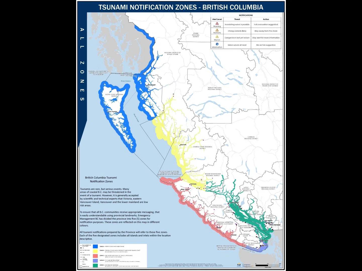
November 5 is World Tsunami Awareness Day, an important reminder for residents along British Columbia’s coast to understand their tsunami notification zone. B.C. is divided into five zones, A through E, which the National Tsunami Warning Center uses to provide location-specific alerts when a tsunami threat occurs.
Zone A, shown in blue, covers the North Coast and Haida Gwaii. Zone B, in orange, includes the Central Coast and northeast Vancouver Island, including communities such as Kitimat, Bella Coola, and Port Hardy. Zone C, in red, spans the outer west coast of Vancouver Island, from Cape Scott to Port Renfrew. Zone D, purple on maps, covers the Juan de Fuca Strait, from Jordan River to Greater Victoria, including the Saanich Peninsula. Finally, Zone E, green, encompasses the Strait of Georgia, Gulf Islands, Greater Vancouver, and Johnstone Strait.
Understanding your zone is essential to knowing whether a tsunami warning, advisory, or watch applies to your area. Alerts provide critical information for evacuation and safety planning.
Take a few minutes today to locate your zone, discuss tsunami preparedness with your family, and review emergency plans. For more information, maps, and preparedness tips, visit PreparedBC.ca/tsunamis.


Comments